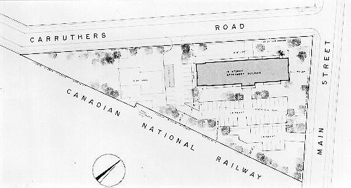
Map of proposed site of 15 storey building, 1971
Description
- Media Type
- Image
- Item Type
- Drawings
- Description
- Map - Proposed site of 15 storey building at corner of Carruthers Road and Main Street.
- Notes
- Physical details: glossy finish, writing on back has pushed through to the front,excellent condition.
- Date of Original
- 23 Dec 1971
- Date Of Event
- 1971
- Dimensions
- 17.5 cm X 9.5 cm
- Subject(s)
- Local identifier
- p8728f.jpg
- Collection
- Georgetown Herald
- Geographic Coverage
-
-
Ontario, Canada
Latitude: 43.65011 Longitude: -79.91634
-
- Copyright Statement
- Copyright status unknown. Responsibility for determining the copyright status and any use rests exclusively with the user.
- Contact
- Esquesing Historical SocietyEmail:esquesinghs@gmail.com
Website:
Agency street/mail address:P.O. Box 51,
Georgetown, ON L7G 4T1


