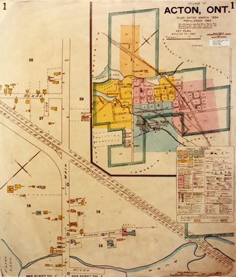
Survey Map
Description
- Media Type
- Image
- Item Type
- Photographs
- Description
- Survey map, Acton, 1922.
- Notes
- Also see For more details see P120, P121, P123.
Physical details: colour prints, matt finish, excellent condition. - Inscriptions
- Map title reads: Acton, Ont., Plan dated March 1934, population 1,885. For information regarding waterworks, Fire protection, etc. see report issued by the Canadian Fire Underwriters Association. Made in Canada by Underwriters Survey Bureau Limited, Toronto and Montréal.
- Date of Original
- 1 Aug 1922
- Date Of Event
- 1922
- Dimensions
- 20 cm X 25.5 cm
- Subject(s)
- Local identifier
- p125f.jpg
- Collection
- Esquesing Historical Society
- Language of Item
- English
- Geographic Coverage
-
-
Ontario, Canada
Latitude: 43.6168 Longitude: -80.03295
-
- Copyright Statement
- Copyright status unknown. Responsibility for determining the copyright status and any use rests exclusively with the user.
- Reproduction Notes
- University of Western Ontario
- Contact
- Esquesing Historical SocietyEmail:esquesinghs@gmail.com
Website:
Agency street/mail address:P.O. Box 51,
Georgetown, ON L7G 4T1


