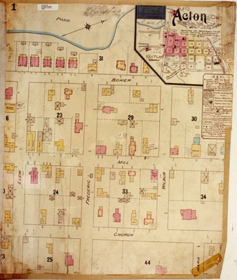
Survey Map
Description
- Media Type
- Image
- Item Type
- Photographs
- Description
- Survey map, Acton, 1904.
- Notes
- Physical details: colour prints, matt finish, excellent condition.
- Inscriptions
- Map title reads: Acton, Ont. Halton Co. Sep.1898. Population 1,500. Water Supply & Tanks & Ponds. Protection Ronald Standard Stm. Eng. 2 reels, a hook & ladder, truck and 500' of hose. Revised Mar. 1904.
- Date of Original
- 1 Mar 1904
- Date Of Event
- 1904
- Dimensions
- 20 cm X 25.5 cm
- Subject(s)
- Local identifier
- p126f.jpg
- Collection
- Esquesing Historical Society
- Language of Item
- English
- Geographic Coverage
-
-
Ontario, Canada
Latitude: 43.6168 Longitude: -80.03295
-
- Copyright Statement
- Copyright status unknown. Responsibility for determining the copyright status and any use rests exclusively with the user.
- Reproduction Notes
- University of Western Ontario
- Contact
- Esquesing Historical SocietyEmail:esquesinghs@gmail.com
Website:
Agency street/mail address:P.O. Box 51,
Georgetown, ON L7G 4T1


