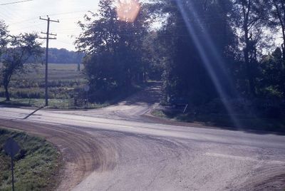
Nassagaweya-Esqueising Townline
Description
- Creator
- Mark Rowe, Photographer
- Media Type
- Image
- Item Type
- Slides
- Description
- CREWSONS CORNERS - Highway #7 runs across this picture with the Esquesing-
Nassagewaya Townline (dead-end) running south. Photo taken by Mark Rowe from on
top of the CNR bridge. - Date of Original
- Sept 25 1993
- Local identifier
- EHS18461
- Geographic Coverage
-
-
Ontario, Canada
Latitude: 43.6168 Longitude: -80.08296
-
- Donor
- J.M. Rowe
- Copyright Statement
- Copyright status unknown. Responsibility for determining the copyright status and any use rests exclusively with the user.
- Contact
- Esquesing Historical SocietyEmail:esquesinghs@gmail.com
Website:
Agency street/mail address:P.O. Box 51,
Georgetown, ON L7G 4T1


