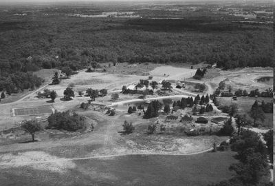
Twin Lakes Arial Photo
Description
- Creator
- Phil Aggus & Son, Hamilton, Photographer
- Media Type
- Image
- Item Type
- Photographs
- Description
- Aerial photo of Twin Lakes flying east, west of #25 highway.
- Date of Original
- 1961
- Local identifier
- EHS12688
- Geographic Coverage
-
-
Ontario, Canada
Latitude: 43.58341 Longitude: -79.96635
-
- Donor
- Russ Miller
- Copyright Statement
- Copyright status unknown. Responsibility for determining the copyright status and any use rests exclusively with the user.
- Contact
- Esquesing Historical SocietyEmail:esquesinghs@gmail.com
Website:
Agency street/mail address:P.O. Box 51,
Georgetown, ON L7G 4T1


