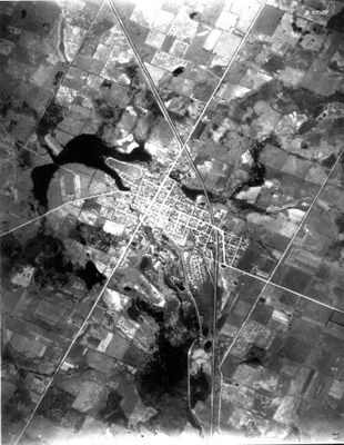
Aerial photograph of part of Acton and Fairy Lake.
Description
- Media Type
- Image
- Item Types
- Photographs
- Black-and-white photographs
- Description
- Aerial photograph of part of Acton with Fairy Lake on the right. Highway #25 cuts diagonally through the photo, intersecting with the CN rail line north of Acton. This photograph has a scale of approximately 1:50 000.
- Date of Publication
- 1934
- Subject(s)
- Local identifier
- EHS25948
- Collection
- HHPL
- Language of Item
- English
- Geographic Coverage
-
-
Ontario, Canada
Latitude: 43.6168 Longitude: -80.03295
-
- Copyright Statement
- Copyright status unknown. Responsibility for determining the copyright status and any use rests exclusively with the user.
- Contact
- Esquesing Historical SocietyEmail:esquesinghs@gmail.com
Website:
Agency street/mail address:P.O. Box 51,
Georgetown, ON L7G 4T1


