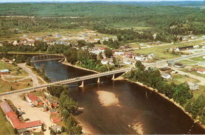
Aerial View of Iron Bridge, Circa 1960
Description
- Médias
- Image
- Type d'élément
- Postcards
- Description
- This color postcard is an aerial view of the town of Iron Bridge.
This photo was taken prior to the original bridge being dismantled and after the new bridge had been put in place. The photo shows most of the town east of the river.
- Date de l'original
- Circa 1960
- Dimensions
-
Largeur: 5.5 in
Hauteur: 3.25 in
- Sujet(s)
- Collection
- Local History
- Langage de l'élément
- English
- Couverture géographique
-
-
Ontario, Canada
Latitude: 46.2788517276862 Longitude: -83.2216786877442
-
- Licence de Creative Commons
 [lisez plus]
- Déclaration de droit d'auteur
- Protected by copyright: Uses other than research or private study require the permission of the rightsholder(s). Responsibility for obtaining permissions and for any use rests exclusively with the user.
- Contacter
- Huron Shores MuseumCourriel:thessalonlib@hotmail.com
Adresse postale d'agence1 James St. P.O. Box 460
Iron Bridge, ON P0R 1H0


