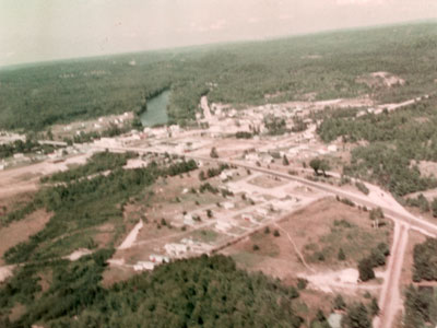
Aerial View, Iron Bridge, Circa 1930
Description
- Médias
- Image
- Type d'élément
- Photographs
- Description
- This is an aerial view taken in color. It shows the eastern and southern sections of Iron Bridge with the river toward the top left of the photo.
- Notes
- The original photo is quite blurred.
- Inscriptions
- "Polaroid" is printed on the matting
- Date de l'original
- Circa 1980
- Dimensions
-
Largeur: 7 in
Hauteur: 5 in
- Sujet(s)
- Collection
- Local History
- Langage de l'élément
- English
- Couverture géographique
-
-
Ontario, Canada
Latitude: 46.28336 Longitude: -83.23318
-
- Donneur
- Mr. Lloyd Allen
- Licence de Creative Commons
 [lisez plus]
- Déclaration de droit d'auteur
- Protected by copyright: Uses other than research or private study require the permission of the rightsholder(s). Responsibility for obtaining permissions and for any use rests exclusively with the user.
- Contacter
- Huron Shores MuseumCourriel:thessalonlib@hotmail.com
Adresse postale d'agence1 James St. P.O. Box 460
Iron Bridge, ON P0R 1H0

