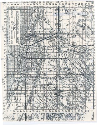
Reproduction of a Topographical map of Cobourg Harbour and shoreline dated 1930
Description
- Media Type
- Image
- Item Types
- Photographs
- Maps
- Description
- Reproduction of a Topographical map of Cobourg Harbour and shoreline dated 1930
Source: unknown
Acquired: June 24, 1992 - Subject(s)
- Local identifier
- cobourg harbour 05-21
- Language of Item
- English
- Geographic Coverage
-
-
Ontario, Canada
Latitude: 43.95977 Longitude: -78.16515
-
- Copyright Statement
- Copyright status unknown. Responsibility for determining the copyright status and any use rests exclusively with the user.
- Contact
- Cobourg Public LibraryEmail:info@cobourg.library.on.ca
Website:
Agency street/mail address:200 Ontario Street, Cobourg, ON K9A 5P4


