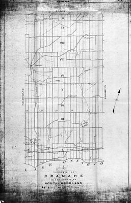
Township of Cramahe in the County of Northumberland, Province of Ontario, Office of Public Roads and Highways, 1915.
Description
- Media Type
- Image
- Item Type
- Maps
- Notes
- Downloaded from Library and Archives Canada.
MIKAN no. 4135090
1 map : Blueline Print ; 83.0 x 51.4.
See 11mp – 1957 pipeline map - which used the 1915 map as a source.
- Inscriptions
- Printed on bottom of map:
Scale 1/2 mile = 1 inch
Province of Ontario
Office of Public Roads and Highways
- Date of Original
- 1915
- Subject(s)
- Local identifier
- 31mp
- Language of Item
- English
- Geographic Coverage
-
-
Ontario, Canada
Latitude: 44.0049356263776 Longitude: -77.8879498413086
-
- Copyright Statement
- Public domain: Copyright has expired according to Canadian law. No restrictions on use.
- Copyright Holder
- Copyright, public domain: Cramahe Township Public Library owns the rights to the archival copy of the digital image.
- Contact
- Cramahe Township Public LibraryEmail:cramlib@cramahetownship.ca
Website:
Agency street/mail address:6 King Street West
PO Box 190
Colborne, ON K0K 1S0


