Postcards of Victoria Square, Colborne
Mapping Victoria Square
Panels
Victoria Square visitorsPark featuresPostcards and souvenirsFacing Victoria SquareMapping Victoria SquareVictoria Square todayLinks
Cramahe - Parks and TrailsCramahe Ecology Garden360 degree panoramic video, Victoria Square, Urban Squares website
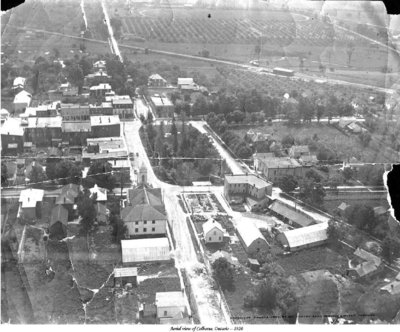
Aerial photo of Colborne including Victoria Square, looking southwards Details
This aerial photograph, which looks southward towards Lake Ontario, shows the total area of Victoria Square and its immediate built and natural areas in 1920. The height and crown spread of the trees in Victoria Square appear to be fairly mature. A large apple orchard can be seen in the background.

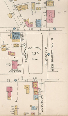
1934 map detail of Victoria Square, north orientation Details
This hand drawn map, with its northward orientation, was made in 1934 and illustrates how the area surrounding Victoria Square shows some new development since the 1920 aerial photo. Most noticeably is the addition of the high school at the corner of Toronto Street and King Street which was built in 1922.
