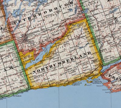
County of Northumberland, Province of Ontario, Department of Lands & Forests, 1950
Description
- Media Type
- Image
- Item Type
- Maps
- Description
- Catalogued on Archives of Ontario website as "County of Northumberland / No. 21a - The Southern Part of the Province of Ontario - (Detail) Northumberland / Province of Ontario. Department of Lands & Forests 1950 / RG 1-707 Ministry of Natural Resources topographic maps / I0034499"
Archives of Ontario image caption "County of Northumberland Once part of the United Counties of Northumberland and Durham, it was partly superseded in 1973, along with Durham County, by the Regional Municipality of Durham."
See link on right to access original source.
- Notes
- Cramahe Archives does not hold the original item in its archives, but has a digital image.
- Date of Original
- 1950
- Subject(s)
- Local identifier
- 32mp
- Language of Item
- English
- Geographic Coverage
-
-
Ontario, Canada
Latitude: 44.00012 Longitude: -77.8828
-
- Copyright Statement
- Copyright status unknown. Responsibility for determining the copyright status and any use rests exclusively with the user.
- Copyright Holder
- Copyright, public domain: Cramahe Township Public Library owns the rights to the archival copy of the digital image.
- Contact
- Cramahe Township Public LibraryEmail:cramlib@cramahetownship.ca
Website:
Agency street/mail address:6 King Street West
PO Box 190
Colborne, ON K0K 1S0


