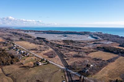
Aerial photograph of Ogden Point Quarry, Cramahe Township, 2022
Description
- Media Type
- Image
- Item Type
- Photographs
- Description
- This image was captured in December 2022 with a DJI Mavic 2 Pro. It shows Ogden Point Quarry looking southwest from Highway 31.
- Subject(s)
- Geographic Coverage
-
-
Ontario, Canada
Latitude: 44.00012 Longitude: -77.8828
-
- Donor
- Steven Lawson
- Creative Commons licence
 [more details]
- Copyright Statement
- Copyright status unknown. Responsibility for determining the copyright status and any use rests exclusively with the user.
- Contact
- Cramahe Township Public LibraryEmail:cramlib@cramahetownship.ca
Website:
Agency street/mail address:6 King Street West
PO Box 190
Colborne, ON K0K 1S0


