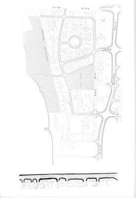
Map of Grimsby beach circa 1950s
Description
- Media Type
- Image
- Text
- Item Types
- Maps
- Measured drawings
- Description
- This is a map of the Grimsby Beach area in the mid-twentieth century. It shows some of the features of the Grimsby Park times which remained through the changing uses of the area. Auditorium Circle, Bell Park, and Victoria Terrace remain today as identified features in the Grimsby Beach area.
- Date of Original
- c. 1950
- Local identifier
- n/a
- Language of Item
- English
- Geographic Coverage
-
-
Ontario, Canada
Latitude: 43.1940367139412 Longitude: -79.525351534996
-
- Donor
- Grimsby Historical Society Archives
- Copyright Statement
- Copyright status unknown. Responsibility for determining the copyright status and any use rests exclusively with the user.
- Location of Original
- Grimsby Historical Society Archives
- Contact
- Grimsby ChautauquaEmail:gen-library@grimsby.ca
Website:
Agency street/mail address:18 Carnegie Lane
Grimsby, ON L3M 1Y1
905.945.5142


