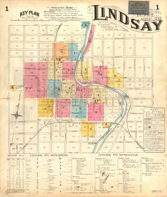
Fire Insurance Maps of Lindsay, Ontario - 1898
Description
- Creator
- Chas. E. Goad, Artist
- Media Type
- Image
- Item Type
- Fire insurance maps
- Description
- Fire insurance maps of Lindsay, Victoria County, Ontario, originally published in August 1898, revised May 1911.
Includes index to street names and index to notable buildings.
Colours on map indicate building material type. See Key for descriptions.
Includes 18 pages of sub-sheets with more detail. - Notes
- Population: 8000
- Publisher
- Chas. E. Goad, Civil Engineer
- Place of Publication
- Toronto, Montreal & London
- Date of Original
- August 1898
- Map Scale
- 500' : 1
- Subject(s)
- Language of Item
- English
- Geographic Coverage
-
-
Ontario, Canada
Latitude: 44.35012 Longitude: -78.73286
-
- Copyright Statement
- Copyright status unknown. Responsibility for determining the copyright status and any use rests exclusively with the user.
- Contact
- Kawartha Lakes Public LibraryEmail:lindsaylibrary@kawarthalakeslibrary.ca
Website:
Agency street/mail address:190 Kent St W.
Lindsay, ON K9V 2Y6
(705) 324-9411 extension 1268


