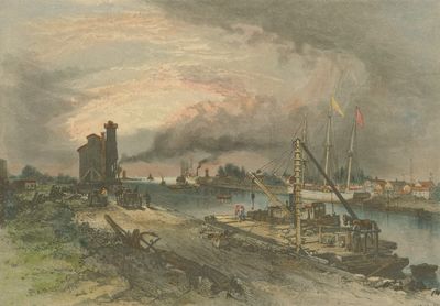
Entrance to Welland Canal
Description
- Media Type
- Image
- Item Types
- Drawings
- Paintings
- Illustrations
- Description
- Illustration of Port Colborne harbour and the southern terminus of the Welland Canal during the second canal era, c.1881. The west pier and lighthouse are depicted in the background.
- Date of Publication
- 1881
- Local identifier
- 996.10.2
- Language of Item
- English
- Geographic Coverage
-
-
Ontario, Canada
Latitude: 42.8823239380261 Longitude: -79.2486728466797
-
- Copyright Statement
- Copyright status unknown. Responsibility for determining the copyright status and any use rests exclusively with the user.
- Contact
- Port Colborne Historical and Marine MuseumEmail:archives@portcolborne.ca
Website:
Agency street/mail address:280 King St. Box 572
Port Colborne, ON L3K 5X8


