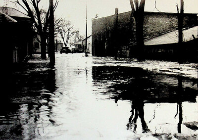
Photograph of 1936 Flood, James St. Stirling
Description
- Media Type
- Image
- Item Type
- Photographs
- Description
- Black and white photograph of 1936 flood. Photograph taken on James St. looking south. Shows the street under water with a couple vehicles in the distance.
- Notes
- Building on right as of 2020 is "Stirling Feed and Seed" at 52 Mill St.
Building south of it on same side was Burkitt's Service Station.
See also: 359ph-364ph - Date of Original
- 1936
- Subject(s)
- Local identifier
- 364ph
- Geographic Coverage
-
-
Ontario, Canada
Latitude: 44.30012 Longitude: -77.54948
-
- Copyright Statement
- Copyright status unknown. Responsibility for determining the copyright status and any use rests exclusively with the user.
- Contact
- Stirling-Rawdon Public LibraryEmail:info@stirlinglibrary.com
Website:
Agency street/mail address:43 West Front St.
P.O. Box 730
Stirling, ON K0K 3E0
(613)395-2837


