Results
- This is an illustrated postcard which is postally used. It has a Smithville, Ont. postmark dated No 9, 1914. It shows an illustration of a young newspaper seller shouting out "Extra!!". His right hanThis is an illustrated postcard which is postally used. It has a …
- While the date is illegible in the postmark, the stamps are 1 cent War Tax stamps which were issued from April 1915 until December 1916.While the date is illegible in the postmark, the stamps are 1 …
- This is a white-bordered, postally unused postcard. It is a photograph by Bruce Murdoch of the beach area of Grimsby Beach. It shows a very active beach with many people in the water and on the shoreThis is a white-bordered, postally unused postcard. It is a photograph by …
- Identity of cottage provided by handwritten note on reverse of postcard.Identity of cottage provided by handwritten note on reverse of postcard.
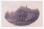
- Spooney Bridge, also known as Spoonery Bridge, was a popular gathering spot at Grimsby Park. It crossed over a ravine.Spooney Bridge, also known as Spoonery Bridge, was a popular gathering spot …
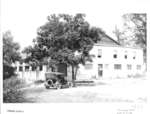
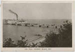
- This photograph shows a team of two horses drawing a wagon taking a drink of Lake Ontario at Grimsby Beach. A man is sitting in the wagon. The Grimsby Beach pier is visible in the background and lookThis photograph shows a team of two horses drawing a wagon taking …
- It became a major attraction in the Grimsby Beach area in the 1920's.It became a major attraction in the Grimsby Beach area in the …
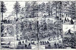
- This is the 1971 reprint of the 1876 Illustrated Historical Atlas of the Counties of Lincoln and WellandThis is the 1971 reprint of the 1876 Illustrated Historical Atlas of …
- This colour postcard shows children playing on the beach at Grimsby Beach. Many of them are standing or sitting on the small planks which served as piers for the canoes. Others are in the water, in tThis colour postcard shows children playing on the beach at Grimsby Beach. …
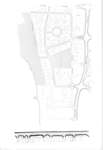
- This is a map of the Grimsby Beach area in the mid-twentieth century. It shows some of the features of the Grimsby Park times which remained through the changing uses of the area. Auditorium Circle,This is a map of the Grimsby Beach area in the mid-twentieth …
- The words "POST CARD" are visible as an imprint from the backside of the photograph.The words "POST CARD" are visible as an imprint from the backside …
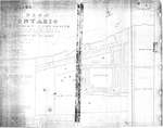
- This is the plan for the Ontario Methodist Camp Ground in 1875. This was the first year that the Ontario Methodist Camp Ground owned the land sold to them by John B. Bowslaugh, which was approximatelThis is the plan for the Ontario Methodist Camp Ground in 1875. …
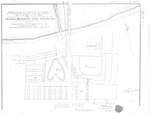
- This map continues the survey of the Ontario Methodist Camp Grounds, plotting the lots for Blocks B. and C., and part of A., D., and F. This map accounts for another approximately 145 lots.This map continues the survey of the Ontario Methodist Camp Grounds, plotting …
- The Grand Trunk Railway provided transportation to Grimsby Park. The railway's timetables are often included in Grimsby Park programs.The Grand Trunk Railway provided transportation to Grimsby Park. The railway's timetables …
- The top porch of the cottage in the foreground is distinct and is shown in other images of Victoria Terrace.The top porch of the cottage in the foreground is distinct and …
- This postcard was used for correspondence with a Grimsby East postmark dated May 24, 1918. The front is a coloured illustration of people looking out from Victoria Terrace to the lake and pier. A steThis postcard was used for correspondence with a Grimsby East postmark dated …
This collection is a partnership between the Grimsby Public Art Gallery, Grimsby Historical Society Archives, Grimsby Public Library and the Town of Grimsby and is made available thanks to financial support from the Government of Ontario.


