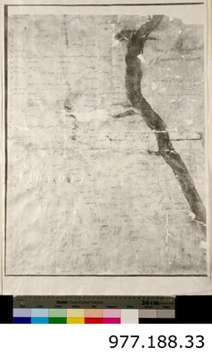
Plan of the Township of Grantham and Louth 1814
Description
- Creator
- R. Home, Artist
- Media Type
- Image
- Item Type
- Maps
- Description
- A Plan of the Township of Grantham and Louth in 1814.
This black and white copy of a map is in poor condition. The map has been copied onto stiff white paper which is 26 3/4 inches x 18 inches in size. The map itself is 22 7/8 inches x 17 1/4 inches.
Concession numbers run down the left side of the map and lot numbers run across the top and bottom of the map.
There are hand written names covering the map. The writing is illegible due to the poor condition of the map, however the names are to show ownership of the properties.
The shore of Lake Ontario is on the right side of the map, marked by the wide black shape. - Notes
- A copy of a map from the National Archives.
- Date of Publication
- 4 Dec 1814
- Dimensions
-
Width: 68 cm
Height: 45.8 cm
- Image Dimensions
-
Image Width: 58.2cm
Image Height: 43.8cm
- Subject(s)
- Local identifier
- T1977.188.33
- Language of Item
- English
- Geographic Coverage
-
-
Ontario, Canada
Latitude: 43.155355684137 Longitude: -79.1940879821777
-
- Donor
- National Archives
- Copyright Statement
- Protected by copyright: Uses other than research or private study require the permission of the rightsholder(s). Responsibility for obtaining permissions and for any use rests exclusively with the user.
- Copyright Date
- 2010
- Recommended Citation
- Image courtesy of the St. Catharines Museum
- Terms of Use
- Please contact the St. Catharines Museum for any reproductions of this image
- Contact
- St. Catharines MuseumEmail:museumcollections@stcatharines.ca
Website:
Agency street/mail address:1932 Welland Canals Parkway P.O. Box 3012 St. Catharines, ON L2R 7C2
Phone: 905-984-8880


