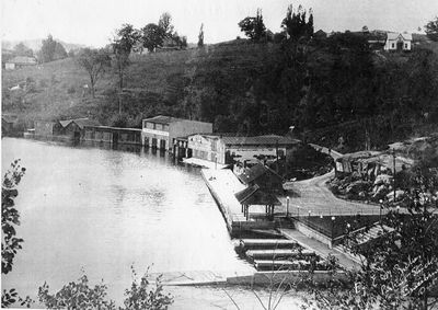
Bracebridge Bay
Description
- Media Type
- Image
- Item Type
- Photocopies
- Description
- A photo of Bracebridge Bay, below the falls, ringed with boat houses, after the new wharf was constructed in 1906.
- Date of Publication
- 8 Jan 2019
- Subject(s)
- Local identifier
- Roy & Lillian Davies collection # 38
- Geographic Coverage
-
-
Ontario, Canada
Latitude: 45.03341 Longitude: -79.31633
-
- Copyright Statement
- Copyright status unknown. Responsibility for determining the copyright status and any use rests exclusively with the user.
- Contact:
- Bracebridge Public Libraryinfo@bracebridgelibrary.ca
94 Manitoba St.
Bracebridge, ON P1L 2B5
(705) 645-4171


