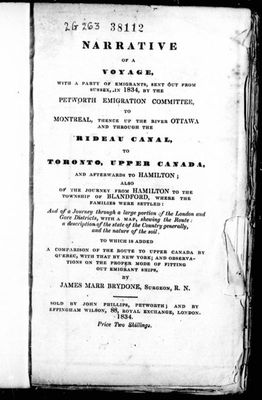
Narrative of a voyage, with a party of emigrants, sent out from Sussex, in 1834
Description
- Creator
- James Marr Brydone; Thomas Sockett; Petworth Emigration Committee, Author
- Media Type
- Publication
- Description
- The full title of this book is "Narrative of a voyage, with a party of emigrants, sent out from Sussex, in 1834, by the Petworth Emigration Committee, to Montreal, thence up the river Ottawa and through the Rideau Canal, to Toronto, Upper Canada, and afterwards to Hamilton: also of the journey from Hamilton to the township of Blandford, where the families were settled : and of a journey through a large portion of the London and Gore districts, with a map, shewing the route; a description of the state of the country generally, and the nature of the soil: to which is added a comparison of the route to Upper Canada by Quebec, with that by New York; and observations on the proper mode of fitting out emigrants ships." An online copy can be found at https://www.canadiana.ca/view/oocihm.21456/1?r=0&s=1 and can also be accessed by using the external link on the right of this page.
Title page
Publisher
p.18 - Old Sly's Falls and Smiths Falls description - "Edmund's Falls; three miles from Maitland's Falls, one lock, with a rise of ten feet: here you see the junction of Emsley [sic], Kitley, Montague, and Wolford: scenery very pretty, the land good, and much cleared: enter the lake Rideau: four miles further, we arrived at Edmund's upper dam: one lock, with a five feet rise.
Old Sly's Falls: four miles, from Edmund's Falls; two locks with a rise of fifteen feet: here you enter the canal, or lock, at a right angle, the passage is narrow, and much incommodated, by about twenty tree stumps, on the projecting angle; which might be easily removed, and the entrance widened by one half; here is plenty of freestone.
Smith's Falls; two and a half miles from Old Sly's Falls; three locks, with a rise of thirty-four feet; here is a small village, rapidly increasing, from the facility of erecting water mills, of which there are already several, in operation, its chief recommendation: here is a rocky island of hard limestone, approaching to marble: the country is swampy, and a chain, of beaver meadows, runs a distance of several miles, back towards Merrickville.
At First rapids, three miles from Smith's Falls, and eight from Oliver's Ferry, there is one lock, with a rise of seven feet." - Notes
- See the Pages box at top of this record and click the downward pointing select arrow to access the pages. Use +/- symbol on the left for resizing. Or click the red arrow 'PDF version of the page' on the right for even greater resizing capabilities.
For further information see - Glenn J. Lockwood. "Smiths Falls: A Social History of the Men and Women in a Rideau Canal Community 1794-1994." Smiths Falls: Corporation of the Town of Smiths Falls, 1994. - Date of Original
- 1834
- Subject(s)
- Geographic Coverage
-
-
Ontario, Canada
Latitude: 44.90011 Longitude: -76.01607
-
- Copyright Statement
- Copyright status unknown. Responsibility for determining the copyright status and any use rests exclusively with the user.
- Contact
- Smiths Falls Public LibraryEmail:info@smithsfallslibrary.ca
Website:
Agency street/mail address:81 Beckwith Street North
Smiths Falls, ON K7A 2B9
Phone number: 613-283-2911


