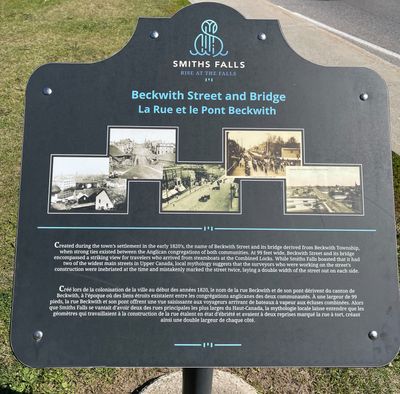
Beckwith Street and Bridge plaque, Smiths Falls
Description
- Media Type
- Object
- Image
- Item Type
- Photographs
- Description
- Located at Veterans' Memorial Park, Beckwith Street and Canal Street.
- Notes
- See the Pages box at top of this record and click the downward pointing select arrow to access an additional photograph of the plaque site looking north on Beckwith Street.
For further information see - Glenn J. Lockwood. "Smiths Falls: A Social History of the Men and Women in a Rideau Canal Community 1794-1994." Smiths Falls: Corporation of the Town of Smiths Falls, 1994. - Inscriptions
- The text on the plaque reads: "Created during the town's settlement during the 1820's, the name of Beckwith Street and its bridge were derived from Beckwith Township, when strong ties existed between the Anglican congregations of both communities. At 99 feet wide, Beckwith Street and its bridge encompassed a striking view for travelers who arrived from steamboats at the Combined Locks. While Smiths Falls boasted that it had two of the widest main streets in Upper Canada, local mythology suggests that the surveyors who were working on the street's construction were inebriated at the time and mistakenly marked the street twice, laying a double width of the street out on each side."
- Subject(s)
- Geographic Coverage
-
-
Ontario, Canada
Latitude: 44.90011 Longitude: -76.01607
-
- Contact
- Smiths Falls Public LibraryEmail:info@smithsfallslibrary.ca
Website:
Agency street/mail address:81 Beckwith Street North
Smiths Falls, ON K7A 2B9
Phone number: 613-283-2911


