Results


Page 1 of 1
- Details of this map were illustrated in Glenn J. Lockwood's "Smiths Falls: A Social History of the Men and Women in a Rideau Canal Community 1794-1994", pp.124-125 - plate 60 - the caption reads: "SeDetails of this map were illustrated in Glenn J. Lockwood's "Smiths Falls: …
- Details of this map were illustrated in Glenn J. Lockwood's "Smiths Falls: A Social History of the Men and Women in a Rideau Canal Community 1794-1994", pp.124-125 - plate 60 - the caption reads: "SeDetails of this map were illustrated in Glenn J. Lockwood's "Smiths Falls: …
- See Glenn J. Lockwood. "Smiths Falls: A Social History of the Men and Women in a Rideau Canal Community 1794-1994." Smiths Falls: Corporation of the Town of Smiths Falls, 1994 for additional plans anSee Glenn J. Lockwood. "Smiths Falls: A Social History of the Men …
- Details of this map were illustrated in Glenn J. Lockwood's "Smiths Falls: A Social History of the Men and Women in a Rideau Canal Community 1794-1994", pp.124-125 - plate 60 - the caption reads: "SeDetails of this map were illustrated in Glenn J. Lockwood's "Smiths Falls: …
- Illustrated in Glenn J. Lockwood's "Smiths Falls: A Social History of the Men and Women in a Rideau Canal Community 1794-1994", p.519 - plate 203 - the caption reads: "Map of the town of Smiths FallsIllustrated in Glenn J. Lockwood's "Smiths Falls: A Social History of the …
- Glenn J. Lockwood. "Smiths Falls: A Social History of the Men and Women in a Rideau Canal Community 1794-1994." Smiths Falls: Corporation of the Town of Smiths Falls, 1994.Glenn J. Lockwood. "Smiths Falls: A Social History of the Men and …
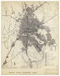
- Cataloguing from York University: Smiths Falls planning area: existing land use Description A map of the Smiths Falls planning around showing existing land use from 1960. It includes different publicCataloguing from York University: Smiths Falls planning area: existing land use Description …
- Glenn J. Lockwood. "Smiths Falls: A Social History of the Men and Women in a Rideau Canal Community 1794-1994." Smiths Falls: Corporation of the Town of Smiths Falls, 1994.Glenn J. Lockwood. "Smiths Falls: A Social History of the Men and …
- Glenn J. Lockwood. "Smiths Falls: A Social History of the Men and Women in a Rideau Canal Community 1794-1994." Smiths Falls: Corporation of the Town of Smiths Falls, 1994. Passfield, Robert W. BuildGlenn J. Lockwood. "Smiths Falls: A Social History of the Men and …
- Glenn J. Lockwood. "Smiths Falls: A Social History of the Men and Women in a Rideau Canal Community 1794-1994." Smiths Falls: Corporation of the Town of Smiths Falls, 1994. Passfield, Robert W. BuildGlenn J. Lockwood. "Smiths Falls: A Social History of the Men and …
- Illustrated in Glenn J. Lockwood's "Smiths Falls: A Social History of the Men and Women in a Rideau Canal Community 1794-1994", p.93 - plate 44 - the caption reads: "Proposal for locating the RideauIllustrated in Glenn J. Lockwood's "Smiths Falls: A Social History of the …
- Glenn J. Lockwood. "Smiths Falls: A Social History of the Men and Women in a Rideau Canal Community 1794-1994." Smiths Falls: Corporation of the Town of Smiths Falls, 1994.Glenn J. Lockwood. "Smiths Falls: A Social History of the Men and …
- See Glenn J. Lockwood. "Smiths Falls: A Social History of the Men and Women in a Rideau Canal Community 1794-1994." Smiths Falls: Corporation of the Town of Smiths Falls, 1994 for additional plans anSee Glenn J. Lockwood. "Smiths Falls: A Social History of the Men …
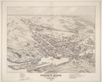
- A detail of this map was illustrated in Glenn J. Lockwood's "Smiths Falls: A Social History of the Men and Women in a Rideau Canal Community 1794-1994", p.17 - plate 9 - the caption reads: "Detail frA detail of this map was illustrated in Glenn J. Lockwood's "Smiths …
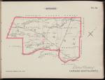
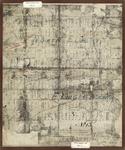
- An image of Frost & Wood Foundry and Machine shop is featured in the upper right hand corner of this map. This record only shows the map that references Smiths Falls and Montague Township. See the exAn image of Frost & Wood Foundry and Machine shop is featured …
Page 1 of 1






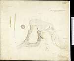
![Plan of resurvey of the land belonging to the ordnance comprising part of Lot n. 30 Con. E township of Wolford County of Leeds Ontario, 1915 [detail of part of Smiths Falls] Plan of resurvey of the land belonging to the ordnance comprising part of Lot n. 30 Con. E township of Wolford County of Leeds Ontario, 1915 [detail of part of Smiths Falls]](https://images.ourontario.ca/Partners/SFPL/SFPL003744348t.jpg)
![Map of the counties of Lanark and Renfrew, Canada West, from actual surveys under the direction of H.F. Walling. [Inset engraving of Frost & Wood Co.], 1863 Map of the counties of Lanark and Renfrew, Canada West, from actual surveys under the direction of H.F. Walling. [Inset engraving of Frost & Wood Co.], 1863](https://images.ourontario.ca/Partners/SFPL/SFPL003704333t.jpg)
