Cobourg and District Images
Canada 150: Cobourg's place in Canadian History
Waterfront and Harbour
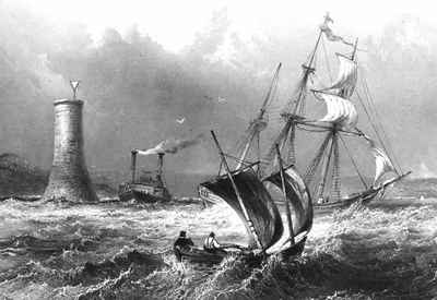
<b>Cobourg light-tower, Gull Island - 1839<b>
Cobourg light-tower, Gull Island - 1839 Details
Midway between Port Hope and Cobourg there is a dangerous shoal called Gull Island, which is about two miles long, and about one mile from the shore. This image was made by W.H. Bartlett a noted English artist.
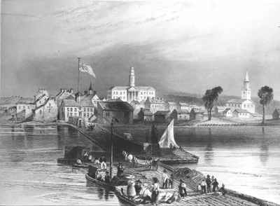
<b>Cobourg - 1840<b>
Cobourg - 1840 Details
The Cobourg Harbour Co. was incorporated and began operating in about 1830, starting with this pier. This first pier began near the entrance to the present trailer park, extended 500 feet into the lake and ended with a lighthouse. This sketch was made by W.H.Bartlett, a noted English artist.
<b>Bathing at Victoria Beach - c.1900<b>
Bathing at Victoria Beach - c.1900 Details
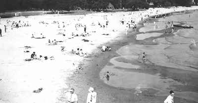
The water slide in the background was a much-loved feature with children hurtling down a wooden slide in a toboggan on wheels. The slide stretched out over the water and into the harbour.
<b>Cobourg Harbour - c.1909<b>
Cobourg Harbour - c.1909 Details
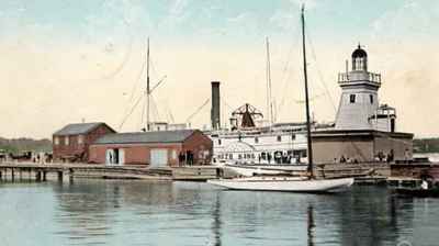
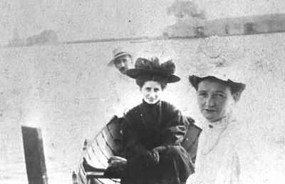
<b>Cobourg Waterfront - c.1910<b>
Cobourg Waterfront - c.1910 Details
Note the row of several private boathouses on the East pier. Also the former Marine Freight Shed and old Light House. Shown is Olive Climo (centre) enjoying a canoe outing with friends.
<b>Yacht Aida - c.1910<b>
Yacht Aida - c.1910 Details
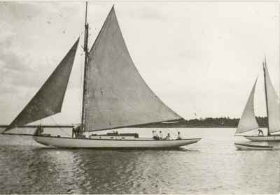
Yachting had been popular in Cobourg as early as the 1850s. Regattas were held in the harbour and Cobourg was a noted shipbuilding centre in the early eighteen-thirties. Later, Cobourg was on of the points on Royal Canadian Yacht Club Three Point race, the others being Toronto and Rochester. This yacht, Aida, was about 56' long plus bowsprit and won many races, cruised lake Ontario and the Bay of Quinte under the Carter family ownership.
<b>S.S. Ontario No. 1 - 1910<b>
S.S. Ontario No. 1 - 1910 Details
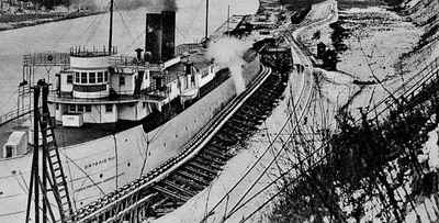
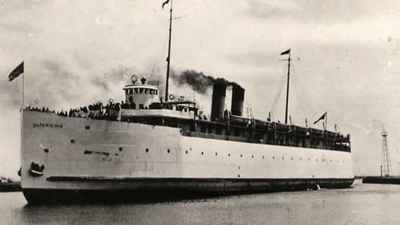
In 1880 Bell, Lewis and Yates Co. built coal docks on the river next to the iron furnace. This area became the Genesee Docks and in 1905 the Grand Trunk Railway and the Buffalo, Rochester and Pittsburgh Railway got a charter for the Ontario Car Ferry Company to handle the coal traffic. The Ontario Car Ferry company was formed in 1905 in a joint venture between the Grand Trunk Railway and the Buffalo, Rochester and Pennsylvania Railroad.
<b>S.S. Ontario No. 1 and No. 2, Cobourg, Ontario - c.1910<b>
S.S. Ontario No. 1 and No. 2, Cobourg, Ontario - c.1910 Details
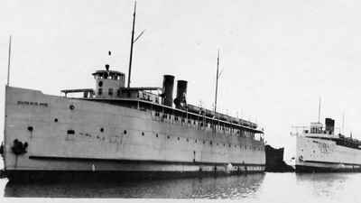
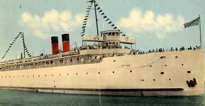
The first ferry, named the Ontario No. 1 was launched in April 1907 and made her first trip with Captain Forrest on November 20th from Charlotte the port for Rochester, New York with a full load of 28 cars of coal. The Ontario No. 2 carried her first load on September 15, 1915, also with Captain Forrest at the helm.
<b>S.S.Ontario No.1 and No.2, Cobourg Harbour, Ontario - c.1910<b>
S.S.Ontario No.1 and No.2, Cobourg Harbour, Ontario - c.1910 Details
<b>Waterfront in Cobourg as seen from an aeroplane - 1919<b>
Waterfront in Cobourg as seen from an aeroplane - 1919 Details
<b>S.S. Ontario No. 2, Cobourg Ontario -c.1920<b>
S.S. Ontario No. 2, Cobourg Ontario -c.1920 Details
Ontario No. 2 was about 307.5 feetlong, 54 foot beam, 20 foot draft, speed 15 mph, capacity 30 loaded cars and 1200 passengers, and cost about $460,000. The Ontario No. 2 did not have an open bridge but was conned from an enclosed raised pilothouse. She had higher horsepower and therefore was somewhat steadier than her sister ship.
<b>Double-deck diving tower - 1923<b>
Double-deck diving tower - 1923 Details
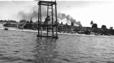
After a few other attemps the young people of the 'Factory Hill community' had success in fashioning this diving platform. The second platform was actually 12 feet above the lake and lasted till the icebergs broke it up in the winter.
<b>S.S. Ontario No.1, Cobourg Ontario - 1927<b>
S.S. Ontario No.1, Cobourg Ontario - 1927 Details
Ontario No. 1 cost about $375,000, was 317 feet long, 54.2 foot beam, 16 1/2 foot draft, speed 13-15mph, capacity of 28 loaded coal cars, 1,000 passengers, berths for 90 people.
<b>Cobourg Beach - c.1950<b>
Cobourg Beach - c.1950 Details
<b>Cobourg Harbour - c.1960<b>
Cobourg Harbour - c.1960 Details
The harbour has been rebuilt, dredged and expanded many times in the past century and a half. It is actually entirely artificial as the bay formed by Midtown Creek was just a swampy inlet, which the Cobourg business people quickly recognized as a great opportunity if it became a major stopping place for trade on route to the Trent and St.Lawrence waterways.
<b>Cobourg Harbour c.1960<b>
Cobourg Harbour c.1960 Details
The Cobourg Harbour Co. owned the harbour for many years but in 1850 the town bought the harbour back at a huge expense. It accomodated railways, steamships and ferries, was disfigured for years by huge piles of coal and gigantic oil tanks.
<b>Victoria Park Beach - c.1960<b>
Victoria Park Beach - c.1960 Details
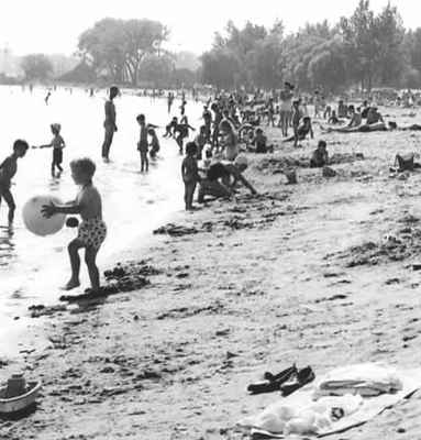
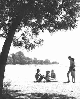
As far back as the early 1800s Cobourg's main beach was used as a stopover location for travellers along the Lake Ontario's north shore. The summer visitors created a wave of new grand hotels to be built in the areas just north of the shoreline and around Victoria Park
<b>Cobourg Beach - 1960<b>
Cobourg Beach - 1960 Details
At the beginning Victoria Park was just one long lawn which belonged to the Arlington Hotel. The grass eventually connected right into the beach. What is now "the crown jewel" of Cobourg was actually privately owned in 1874 but still accessible to the public.
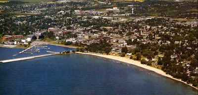
<b>Cobourg Lakefront- 1984<b>
Cobourg Lakefront- 1984 Details
This photograph was taken by Canadian aerial photographer Harry Oakman.
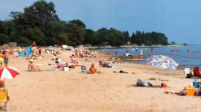
<b>Cobourg Beach - c.1994<b>
Cobourg Beach - c.1994 Details
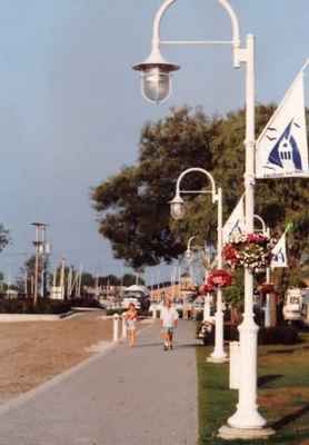
<b>Cobourg promenade - 1994<b>
Cobourg promenade - 1994 Details
Cobourg promenade, along the beach in Victoria Park, on the shore of Lake Ontario.
Powered by / Alimenté par VITA Toolkit
Privacy Policy