Colborne Railroad Stations
Map Details of Railway Lines in Colborne
Pages
Colborne Train StationsTrain LinesPeopleRailway Station MastersThe End of the LineMap Details of Railway Lines in ColborneLinks
The Age of the Iron Horse by Eileen Argyris, p.50The Age of the Iron Horse by Eileen Argyris, p.51Changes at Colborne Grand Trunk Railway Station newspaper clippingRailways CN Images of Canada GalleryRailway History in Canada
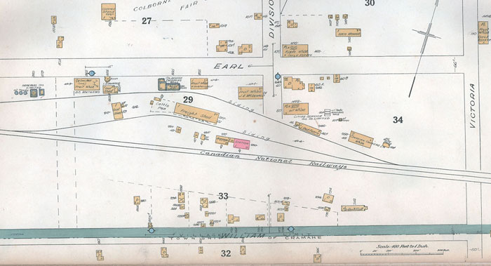
Canadian National Railways, Colborne, 1934 map detail Details
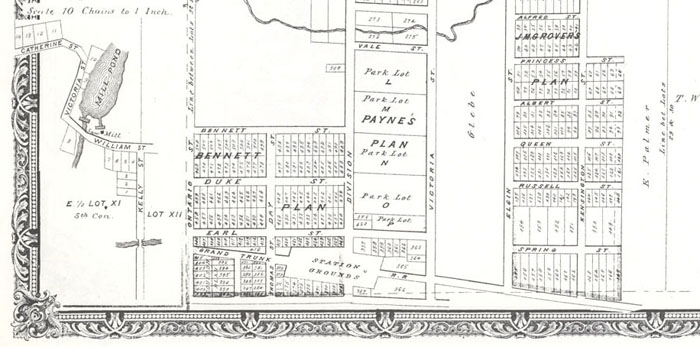
These two maps show the route that Grand Trunk Railways and Canadian National Railways used in Colborne. One of the maps, shown here in detail, appeared in the 1878 Illustrated Historical Atlas. The other map is from a 1934 hand drawn map and illustrates in great detail the location of the Canadian National Railways and the surrounding businesses that depended upon the import and export of shipments. The 1878 Illustrated Historical Atlas and the 1934 colour map are in the Cramahe Digital Archives. To see these maps and zoomify the details, go to Browse by Subject and click on maps in the alphabetical listing of subjects. The results of this search will bring up the 1878 Illustrated Historical Atlas and the 1934 colour map, among others. Go into the individual record and use the drop down page locator, select the desired map and multiple clicks with increase the level of detail in zoomify.

Grand Trunk Station, Colborne, 1878 map detail Details
